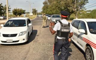
State of emergency declared in high-crime areas, including Old Harbour

This decision follows a sharp rise in gang-related violence and criminal activities in these areas, which have been deemed hotspots for public safety risks. These locations, which also serve as key thoroughfares for residents, commuters, and bystanders, are now the focus of intensified security operations.
Addressing the Surge in Violence
Intelligence assessments have shown that standard policing strategies are no longer sufficient to manage the level of violence in these communities. The declaration of the SOPE will allow for the deployment of enhanced security measures aimed at dismantling criminal networks, apprehending offenders, and restoring order. The operations will be carried out with respect for constitutional safeguards and citizens’ rights.
The Jamaican government has also emphasized that security efforts will be complemented by long-term social intervention programs. These initiatives aim to address the root causes of violence and provide sustainable solutions to the social and economic challenges faced by residents in the affected areas.
Boundaries of the Affected Areas
The geographical boundaries of the State of Public Emergency are defined as follows:
St. Andrew South Police Division
• East: Begins at the intersection of Perkins Boulevard, Molynes Road, and Red Hills Road, extending along Molynes Road, Seaward Drive, and other thoroughfares to the intersection with Maxfield Avenue.
• South: Extends from Chisolm Avenue and Maxfield Avenue to the coastline near Petrojam, then along the Kingston Container Terminal to the Portmore Causeway Bridge.
• West: Follows the shared parish border of St. Andrew and St. Catherine.
• North: Extends along the Belvedere to Ferry Road back to Perkins Boulevard.
St. Andrew Central Police Division
•East: From southeast of Derby Peak to Cane River.
• South: Along Cane River to Dallas Mountain, then through August Town and other areas, ending at Maxfield Avenue.
•West: Continues northwest along Maxfield Avenue and connects to Waltham Park Road and Seaward Drive.
• North: Extends from Washington Boulevard to East Kings House Road and Barbican Road, ending at Derby Peak.
Kingston Western Police Division:
• North: Starts at Maxfield Avenue and Rousseau Road, extending eastward to Lyndhurst Road.
• East: Continues along Slipe Road, Orange Street, and North Street, down to Ocean Boulevard.
• South: Stretches along the Kingston coastline to East Avenue.
• West: Runs northeast from East Avenue back to Maxfield Avenue.
St. Catherine South Police Division
• East: From Rock Hall to the Kingston Container Terminal.
• South: Along the coastline to the boundary between St. Catherine and Clarendon.
• West: Extends north along the St. Catherine-Clarendon boundary.
• North: Runs southeast along Old Harbour Road and the P.J. Patterson Highway back to Rock Hall.
As for the Old Harbour area in general, members of the public should anticipate delays due to several security checkpoints assembled throughout the police subdivision which has recorded four murders since the year began, three of which occurred in four days.
Investigators, however, noted that all four homicides are unrelated based on investigations.
Old Harbour News is a community-based online news media outlet based in Jamaica with more than 300,000 unique visitors since 2013. However, we are soliciting your support to continue provide independent journalism and unique stories tailored just for you. Your contribution, however small it may be, will ensure our service to you remain independent and grow to serve you better. Click the DONATE BUTTON now to support Old Harbour News. Thank you.


